


このアプリのYoutube動画がある場合はURLを送信してください。詳細 »
APPLICATION INFO - iPhoneアプリの詳細情報
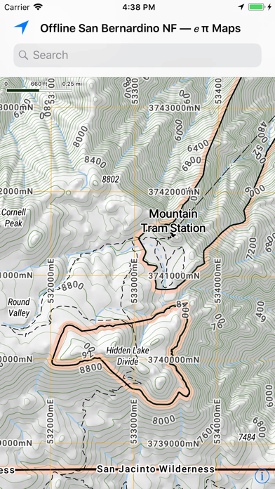
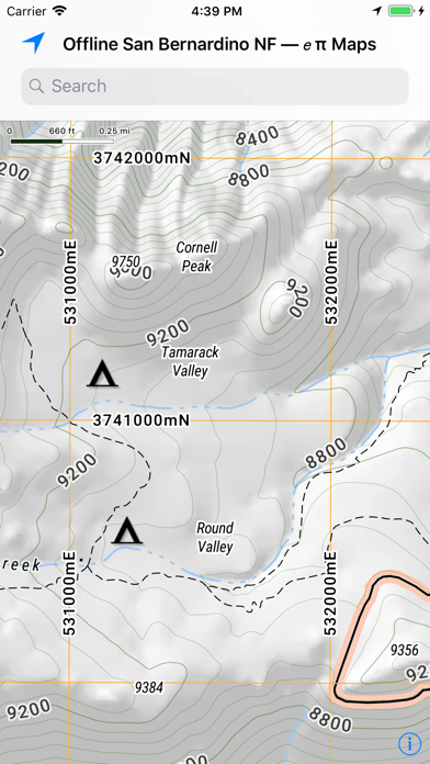
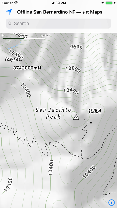
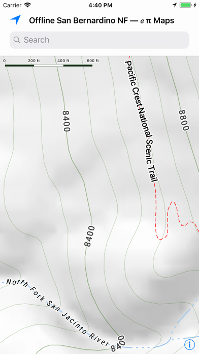
Enjoy Mount San Jacinto State Park with our completely Offline map. See this full map online at RobLabs.com/sbnf
Features
— This eπ Map is completely offline.
— Use your GPS to see your location on the trail.
— Now with beautiful shaded relief.
— Topographic map with 40 feet contour intervals.
Your Trip, your privacy
— Works offline without a network
— After the initial app download from the Apple App Store, no server is necessary
— We don't track your location
— We don't have analytics in our app
— We don't care where you go, we just want you to enjoy yourself safely
eπ Maps is powered by OpenGL with vector based maps built with Open Map Tiles, and hill shaded relief raster maps built with GDAL and WebP.
Usage
— Pan to move
— Pinch to zoom
— Use two fingers to rotate
— Double-tap to zoom in one level
— Two-finger single-tap to zoom out one level
— Double-tap, long-pressing the second, then pan up and down to "quick zoom" (one hand mode)
Legal
— Publisher assumes no liability for safety or condition of roads or trails. Map is not intended for navigational use and is not represented to be correct in every aspect. Consult federal, state, and local laws for current regulations.
— This map is not a legal document. Boundaries may be generalized for this map scale. Private lands within government reservations may not be shown. Obtain permissions before entering private lands.
— © OpenMapTiles for Vector Tile processing
— © OpenStreetMap contributors
— © Open DEM, Open Database License (OdBL), for Contours in metric.
— © USGS, for Hill Shaded Relief and 40 foot contour intervals. Contours derived from the National Elevation Dataset.
— Please see the full terms and conditions at http://RobLabs.com/Legal
 このアプリはiPhone、iPadの両方に対応しています。
カテゴリー
ナビゲーション
ナビゲーション
リリース
2018/3/28
2018/3/28
更新
2018/4/22
2018/4/22
バージョン
2.363.582
2.363.582
言語
サイズ
150.9 MB
150.9 MB
条件
このバージョンの新機能
— We have added the Front Country Ranger District and the Mountaintop Ranger District; San Jacinto Ranger District is there, too.
— Now all three Ranger Districts of the San Bernardino National Forest are offline.
— Offline Maps, Go Well Prepared.
— Your
— We have added the Front Country Ranger District and the Mountaintop Ranger District; San Jacinto Ranger District is there, too.
— Now all three Ranger Districts of the San Bernardino National Forest are offline.
— Offline Maps, Go Well Prepared.
— Your
スクリーンショット - iPhone | iPad
スクリーンショット - iPhone | iPad
ePi Rational, Inc. の他のアプリ » もっと見る
» 目的別iPhoneアプリ検索
- 辞書 » 日本語対応の辞書 » 英和辞典
- 学習 » 英単語 » 英会話 » クイズで楽しく
- スケジュール » 管理 » Googleカレンダー


Yahoo!乗換案内
Yahoo Japan Corp.無料
Google マップ - ナビ、乗換案内
Google LLC無料
Yahoo!カーナビ
Yahoo Japan Corp.無料
乗換NAVITIME(乗換ナビタイム) - 運行情報や路線図..
NAVITIME JAPAN CO.,LTD.無料
Yahoo! MAP-ヤフーマップ
Yahoo Japan Corp.無料
乗換案内
Jorudan Co.,Ltd.無料
賃貸物件検索 SUUMO(スーモ)でお部屋探し
Recruit Co.,Ltd.無料
NAVITIME(乗換と地図の総合ナビ)
NAVITIME JAPAN CO.,LTD.無料
NAVITIMEドライブサポーター - カーナビ&渋滞情報&..
NAVITIME JAPAN CO.,LTD.無料
お部屋探しはライフルホームズ賃貸・マンション・不動産物件検索
LIFULL Co., Ltd無料


CatchApp新着アプリレビュー
 日本縦断てつどうの旅」")
様々な楽しみ方で運転士として成長していく鉄道運転士育成RPG「プラチナ・トレイン(プラトレ) 日本縦断てつどうの旅」
2016-05-17 00:00

日本語にはない英語発音のリスニングを楽しく学べる「発音どっち?英語リスニング 」
2014-12-20 12:00

指先の瞬発力が試されるカジュアルゲーム「早撃ちパニック」をリリース!
2014-12-08 15:21
新着アプリ動画
-
 ¥1500
¥1500
-
 ¥600
¥600
-
 ¥3000
¥3000