


このアプリのYoutube動画がある場合はURLを送信してください。詳細 »
APPLICATION INFO - iPhoneアプリの詳細情報
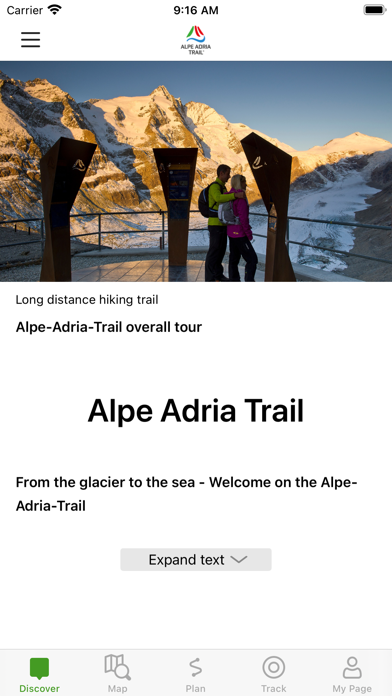
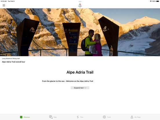
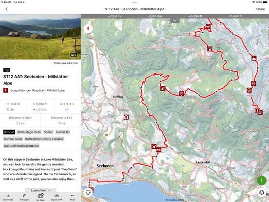
The Alpe-Adria-Trail connects the three regions of Carinthia, Slovenia and Friuli-Venezia Giulia, and covers a total of 43 stages. The long distance hiking route leads from the foot of the highest mountain in Austria, the Grossglockner, through the beautiful Carinthian mountain and lake districts near where the three countries – Austria, Italy and Slovenia – meet. The Triglav National Park, the Soča Valley, the wine-growing regions of Colli Orientali and Goriška Brda and the Karst are further unique areas you will pass before finally reaching Muggia at the Adriatic Sea.
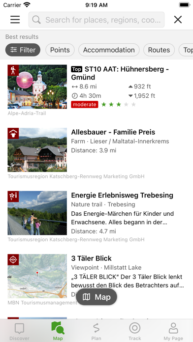
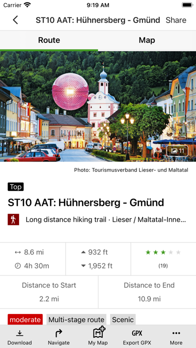
An essential component of the app is the detailed information that is provided for each stage: the course of the stages, attractions and establishments.
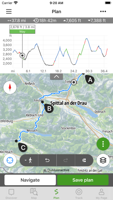
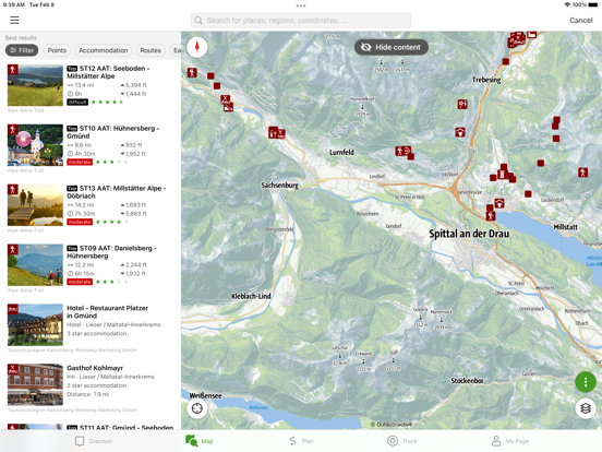
The tours/stages, including all tour details and relevant map sections, can be stored on a smartphone and can be accessed offline, if required (for example, if you are in another country, in areas with weak network coverage, or when data roaming would be too expensive).
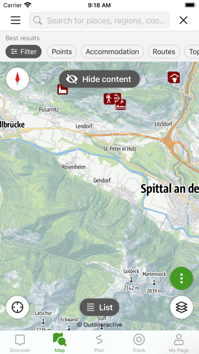
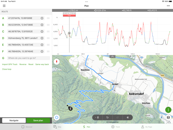
The tour descriptions contain all the facts, images and elevation profiles you might need. As soon as a tour is started, you can determine your own position (including determining which direction you are facing) easily in the topographic map and, in this way, follow the course of the route.
Please note: In other countries high roaming costs can occur, therefore, when using the app, make sure all necessary information can be accessed offline by downloading it at a flat rate or via Wi-Fi before starting your journey.
Background use of the app with activated GPS reception can drastically shorten battery life!
Apple Health:
When you record a cycling, hiking, walking or running track you are able to save work outs to Apple Health. Data from HealthKit will not be used for marketing or promotional purposes.
An essential component of the app is the detailed information that is provided for each stage: the course of the stages, attractions and establishments.
The tours/stages, including all tour details and relevant map sections, can be stored on a smartphone and can be accessed offline, if required (for example, if you are in another country, in areas with weak network coverage, or when data roaming would be too expensive).
The tour descriptions contain all the facts, images and elevation profiles you might need. As soon as a tour is started, you can determine your own position (including determining which direction you are facing) easily in the topographic map and, in this way, follow the course of the route.
Please note: In other countries high roaming costs can occur, therefore, when using the app, make sure all necessary information can be accessed offline by downloading it at a flat rate or via Wi-Fi before starting your journey.
Background use of the app with activated GPS reception can drastically shorten battery life!
Apple Health:
When you record a cycling, hiking, walking or running track you are able to save work outs to Apple Health. Data from HealthKit will not be used for marketing or promotional purposes.
 このアプリはiPhone、iPadの両方に対応しています。
カテゴリー
旅行
旅行
リリース
2022/2/15
2022/2/15
バージョン
1.0
1.0
言語
サイズ
75.6 MB
75.6 MB
条件
スクリーンショット - iPhone | iPad
スクリーンショット - iPhone | iPad
Outdooractive AG の他のアプリ » もっと見る
» 目的別iPhoneアプリ検索
- 辞書 » 日本語対応の辞書 » 英和辞典
- 学習 » 英単語 » 英会話 » クイズで楽しく
- スケジュール » 管理 » Googleカレンダー


Google Earth
Google LLC無料
じゃらん
Recruit Co.,Ltd.無料
楽天トラベル
Rakuten Travel Inc.無料
ホテルズドットコム - 国内・海外のホテルをお得に予約
Hotels.com無料
ANA
ANA (All Nippon Airways)無料
アトラクション待ち時間
NORIHIKO HAYASAKA無料
エクスペディア - ホテル予約、格安航空券&現地ツアー予約
Expedia, Inc.無料
まっぷるリンク
Shobunsha Publications, Inc.無料
週刊じゃらん -旬の観光・グルメ・宿情報をまとめ読み
Recruit Co.,Ltd.無料
ホテル予約 厳選20社 旅比較ねっと
BIGLOBE Inc.無料


CatchApp新着アプリレビュー
 日本縦断てつどうの旅」")
様々な楽しみ方で運転士として成長していく鉄道運転士育成RPG「プラチナ・トレイン(プラトレ) 日本縦断てつどうの旅」
2016-05-17 00:00

日本語にはない英語発音のリスニングを楽しく学べる「発音どっち?英語リスニング 」
2014-12-20 12:00

指先の瞬発力が試されるカジュアルゲーム「早撃ちパニック」をリリース!
2014-12-08 15:21
新着アプリ動画
-
 ¥1500
¥1500
-
 ¥600
¥600
-
 ¥3000
¥3000