


このアプリのYoutube動画がある場合はURLを送信してください。詳細 »
APPLICATION INFO - iPhoneアプリの詳細情報
IMPORTANT: *REQUIRES* ArcGIS Online Named User account.
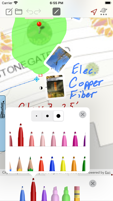
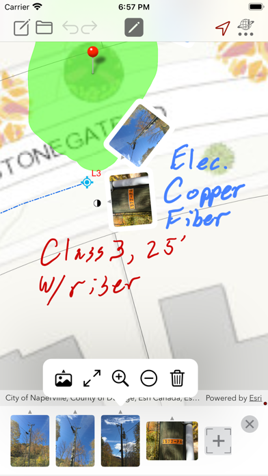
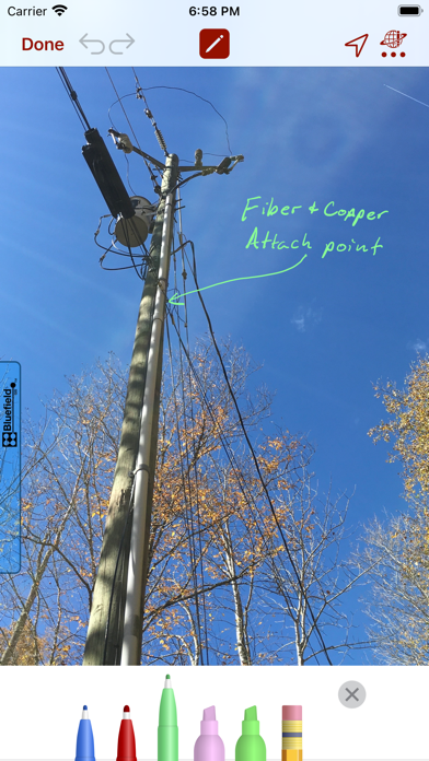
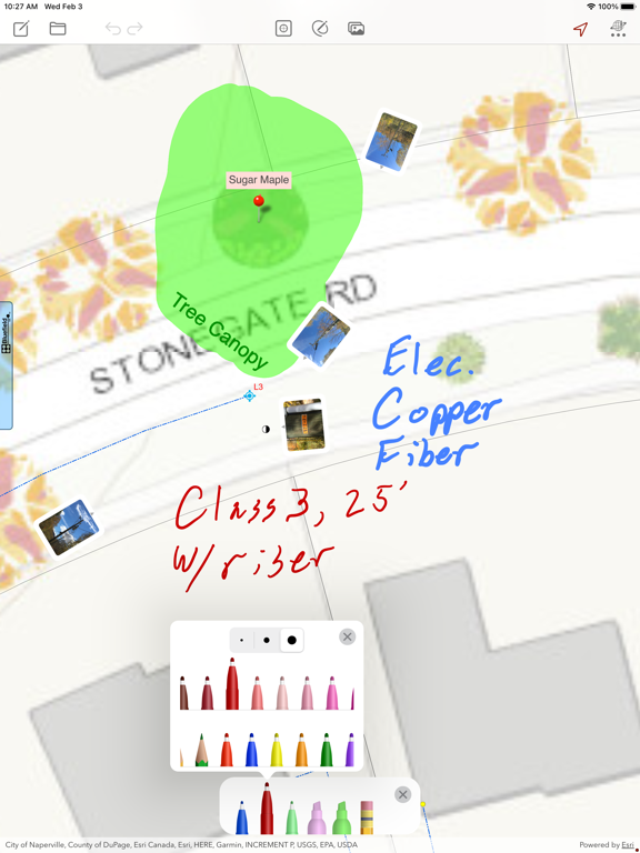
Map notes on your web maps made easy. Draw Maps for ArcGIS gives you color pens and pencils to make sketches and take notes anywhere in the map. Add map pins and photos to note important locations. Think of the whole world as being your sketch pad. Move around and zoom to different scales as you draw. Your notes and photos are instantly available in your ArcGIS Online organization as standard features. Collaborate with others on one map in near real-time (multi-user notes). Take notes while offline using downloaded map packages. Share your maps with friends and business associates.
Features:
- Draw and highlight in the map
- Place colored map pins in the map and add long form notes
- Place photos in the map
- Draw and highlight in the photos
- 72 colors
- Use the stencil to draw perfect shapes or labels
- Move and zoom the map as needed while you draw
- Join collaborations hosted in web maps that are Draw Maps enabled
- Take your maps offline with Map Package Download
- Create documents on the device and draw using any web map or basemap as your background
- Send images of your map drawings to other people
- Send your Draw Maps Document to another Draw Maps user
- Send KML
- Archive your Draw Maps Document to online storage
- Make as many maps and join as many collaborations as you like
- Works great with Apple Pencil
Example use cases:
- Mining: Take field notes while prospecting (where there is no cell coverage)
- Real Estate: Sketch alternatives while meeting with clients
- Utilities: Survey damage the day after a storm
- Contracting: Document your finished work and include with deliverables.
Currently supports drawing on any ArcGIS Online web map. Please contact us if ArcGIS Enterprise support a requirement.
Currently supports English, Finnish, French, German, Indonesian, Portuguese, Spanish, and Thai.
 このアプリはiPhone、iPadの両方に対応しています。
カテゴリー
ナビゲーション
ナビゲーション
リリース
2019/2/8
2019/2/8
更新
2021/4/23
2021/4/23
バージョン
5.0.4
5.0.4
言語
サイズ
104.8 MB
104.8 MB
条件
このバージョンの新機能
Thank you for your feedback. New in this release:
- Broader connection and sync logging to help find communication problems in Collaboration maps.
Thank you for your feedback. New in this release:
- Broader connection and sync logging to help find communication problems in Collaboration maps.
スクリーンショット - iPhone | iPad
スクリーンショット - iPhone | iPad
Bluefield GIS, Inc. の他のアプリ » もっと見る
» 目的別iPhoneアプリ検索
- 辞書 » 日本語対応の辞書 » 英和辞典
- 学習 » 英単語 » 英会話 » クイズで楽しく
- スケジュール » 管理 » Googleカレンダー


Yahoo!乗換案内
Yahoo Japan Corp.無料
Google マップ - ナビ、乗換案内
Google LLC無料
Yahoo!カーナビ
Yahoo Japan Corp.無料
乗換NAVITIME(乗換ナビタイム) - 運行情報や路線図..
NAVITIME JAPAN CO.,LTD.無料
Yahoo! MAP-ヤフーマップ
Yahoo Japan Corp.無料
乗換案内
Jorudan Co.,Ltd.無料
賃貸物件検索 SUUMO(スーモ)でお部屋探し
Recruit Co.,Ltd.無料
NAVITIME(乗換と地図の総合ナビ)
NAVITIME JAPAN CO.,LTD.無料
NAVITIMEドライブサポーター - カーナビ&渋滞情報&..
NAVITIME JAPAN CO.,LTD.無料
お部屋探しはライフルホームズ賃貸・マンション・不動産物件検索
LIFULL Co., Ltd無料


CatchApp新着アプリレビュー
 日本縦断てつどうの旅」")
様々な楽しみ方で運転士として成長していく鉄道運転士育成RPG「プラチナ・トレイン(プラトレ) 日本縦断てつどうの旅」
2016-05-17 00:00

日本語にはない英語発音のリスニングを楽しく学べる「発音どっち?英語リスニング 」
2014-12-20 12:00

指先の瞬発力が試されるカジュアルゲーム「早撃ちパニック」をリリース!
2014-12-08 15:21
新着アプリ動画
-
 ¥1500
¥1500
-
 ¥600
¥600
-
 ¥3000
¥3000