


このアプリのYoutube動画がある場合はURLを送信してください。詳細 »
APPLICATION INFO - iPhoneアプリの詳細情報
A must have toolkit for every outdoor enthusiast: climber, hiker, off-road driver. All the essential tools for navigation are integrated seamlessly in one app.
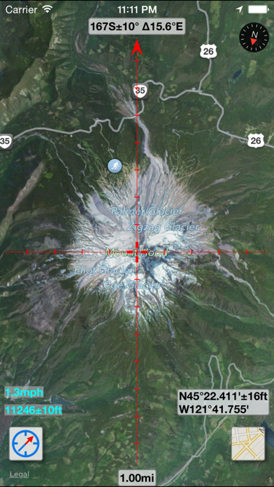
MapTool combines full screen map, GPS, compass, altitude, UTM, Magnetic declination, precision grid and more.
GPS with COMPASS
Both GPS and Compass are displayed on the map with a high precision grid. Accuracy (±) is indicated to check signal quality or magnetic interference.
ALTITUDE
Current altitude is displayed with accuracy (±) in GPS mode.
SPEED
Current speed calculated by iPhone GPS
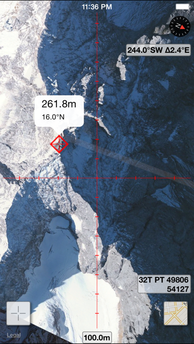
UTM Coordinates
WGS84/NAD83 UTM coordinates are displayed in real time and in map browsing mode (click Location button).
MGRS and Compass Mils
(click Location button)
MAGNETIC Declination
Current magnetic declination (∆) for the entire world using World Magnetic Model (WMM). A must have feature for those that use a physical compass as well.
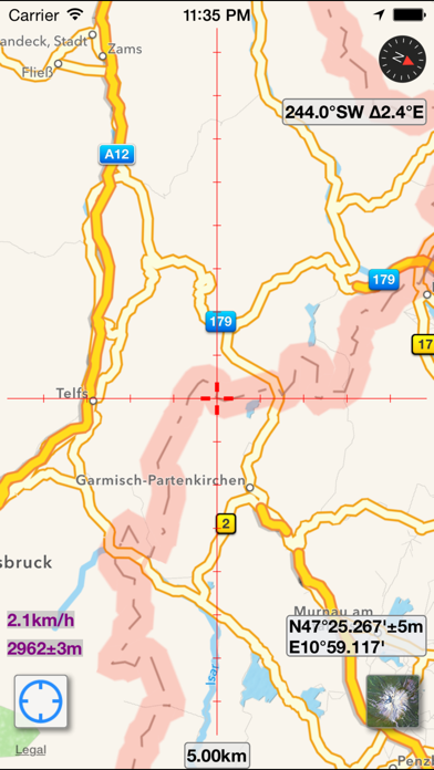
MAP Browsing
Map browsing with Latitude/Longitude or UTM coordinates for the entire world.
MAP Grid
High precision grid combined with predefined scale values for both metric and feet/miles (click Scale button)
BATTERY Friendly
Turns off GPS in compass only and browsing modes to improve battery savings
MapTool combines full screen map, GPS, compass, altitude, UTM, Magnetic declination, precision grid and more.
GPS with COMPASS
Both GPS and Compass are displayed on the map with a high precision grid. Accuracy (±) is indicated to check signal quality or magnetic interference.
ALTITUDE
Current altitude is displayed with accuracy (±) in GPS mode.
SPEED
Current speed calculated by iPhone GPS
UTM Coordinates
WGS84/NAD83 UTM coordinates are displayed in real time and in map browsing mode (click Location button).
MGRS and Compass Mils
(click Location button)
MAGNETIC Declination
Current magnetic declination (∆) for the entire world using World Magnetic Model (WMM). A must have feature for those that use a physical compass as well.
MAP Browsing
Map browsing with Latitude/Longitude or UTM coordinates for the entire world.
MAP Grid
High precision grid combined with predefined scale values for both metric and feet/miles (click Scale button)
BATTERY Friendly
Turns off GPS in compass only and browsing modes to improve battery savings
カテゴリー
ナビゲーション
ナビゲーション
リリース
2014/1/9
2014/1/9
更新
2014/9/27
2014/9/27
バージョン
1.3.0
1.3.0
言語
サイズ
6.8 MB
6.8 MB
条件
このバージョンの新機能
* Updated for iOS 8
* Minor bug fixes
* Updated for iOS 8
* Minor bug fixes
スクリーンショット
» 目的別iPhoneアプリ検索
- 辞書 » 日本語対応の辞書 » 英和辞典
- 学習 » 英単語 » 英会話 » クイズで楽しく
- スケジュール » 管理 » Googleカレンダー


Yahoo!乗換案内
Yahoo Japan Corp.無料
Google マップ - ナビ、乗換案内
Google LLC無料
Yahoo!カーナビ
Yahoo Japan Corp.無料
乗換NAVITIME(乗換ナビタイム) - 運行情報や路線図..
NAVITIME JAPAN CO.,LTD.無料
Yahoo! MAP-ヤフーマップ
Yahoo Japan Corp.無料
乗換案内
Jorudan Co.,Ltd.無料
賃貸物件検索 SUUMO(スーモ)でお部屋探し
Recruit Co.,Ltd.無料
NAVITIME(乗換と地図の総合ナビ)
NAVITIME JAPAN CO.,LTD.無料
NAVITIMEドライブサポーター - カーナビ&渋滞情報&..
NAVITIME JAPAN CO.,LTD.無料
お部屋探しはライフルホームズ賃貸・マンション・不動産物件検索
LIFULL Co., Ltd無料


CatchApp新着アプリレビュー
 日本縦断てつどうの旅」")
様々な楽しみ方で運転士として成長していく鉄道運転士育成RPG「プラチナ・トレイン(プラトレ) 日本縦断てつどうの旅」
2016-05-17 00:00

日本語にはない英語発音のリスニングを楽しく学べる「発音どっち?英語リスニング 」
2014-12-20 12:00

指先の瞬発力が試されるカジュアルゲーム「早撃ちパニック」をリリース!
2014-12-08 15:21
新着アプリ動画
-
 ¥1500
¥1500
-
 ¥600
¥600
-
 ¥3000
¥3000